
Phoenix Neighbor Sources by Block
A reliable block lookup separates parcels, owners, occupants, and civic contacts. Phoenix sits mainly in Maricopa County, so the county Assessor and Parcel Viewer form the land layer. City systems add neighborhood boundaries, nearby permits, certificates, and code cases. Arizona voter data is tightly governed and does not work as an open block browser. Historical reverse directories can show older occupants when a volume supports address-first access.
| Official source | Block-level evidence | How it is accessed |
|---|---|---|
| Assessor Parcel Viewer | Selected parcels, owners, APNs, values, lot and jurisdiction facts | Free map selection, shapes, and buffers |
| Assessor parcel record | Situs, owner, mailing address, legal description, and deed bridge | Free address, owner, APN, city, or ZIP search |
| My Community Map | Nearby permits, zoning, and cases in the current extent | Free map and adjustable Near Me radius |
| Neighborhood Link | Group name, boundary, and listed leadership contact | Address, geographic-area, map, and list searches |
| Authorized voter file | Residence and ZIP fields for a permitted statutory purpose | Certified request, purpose limits, and statutory fees |
| Historical reverse directory | Past occupants by address where that volume includes a reverse section | Arizona Memory Project or library research |
An owner name is not a household roster. The owner may receive mail elsewhere, and renters or relatives may not appear in parcel data at all. Treat every source according to the event it records. For Phoenix neighbors, the parcel map proves which lots touch; the detailed roll identifies recorded interests; the neighborhood directory identifies civic organizations, not every resident.
Select Phoenix Neighbors on the Map
The Maricopa County Assessor Parcel Viewer is designed for spatial questions. Choose the Parcels layer and locate the starting address. Clicking a parcel opens Feature Information. Holding Ctrl while clicking adds more parcels, and the arrows move through the selected set. The results tab can zoom to each lot, while Open Attribute Table places the selected records side by side.
- Search the exact address and confirm its situs, APN, and jurisdiction.
- Select the lots beside, behind, and across from the starting parcel.
- Record each APN, owner name, subdivision, lot, block, and retrieval date.
- Open the detailed Assessor record when a mailing address or linked deed is needed.
- Keep owner and occupant conclusions separate. A mailing-situs match can support, but never prove, occupancy.
Open the official Parcel Viewer selection and buffer help.
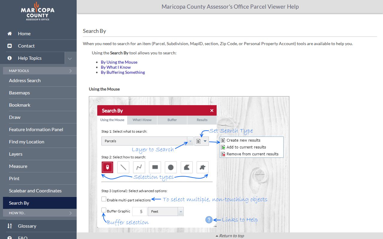
The help screen documents point, extent, circle, polygon, line, and buffer tools. Those controls let the search follow the real block shape rather than a guessed street-name boundary.
Parcel records also solve jurisdiction errors. A postal city of Phoenix does not prove that land lies within city limits, and some municipal edges extend into Pinal County. For a whole named street and its deed chain, move to the Phoenix Street Directory after defining the immediate block.
Shape a Phoenix Neighbor Radius
One click is enough for an adjacent lot, but irregular Phoenix blocks often need a shape. Parcel Viewer offers Extent, Polygon, Line, Circle, and Freehand Polygon selections. Results can replace the current set, add to it, or remove parcels. Buffer Graphic adds a distance around a chosen feature, while multi-part selection supports separated groups.
Use the smallest shape that answers the question. A line can follow one side of a short block. A polygon can avoid a canal, freeway, preserve, or large commercial parcel. A circle is useful for a simple radius, but it may cross a physical barrier that neighbors do not share. Save the map extent and retrieval date because ownership, value, and city layers change.
My Community Map uses the current extent for a Neighborhood Summary and offers a Near Me search with an adjustable buffer that starts at one mile. That is broad for immediate neighbors. Narrow it when possible, then compare the returned permit or zoning point to the underlying address record.
Find Phoenix Neighborhood Groups
Phoenix Neighborhood Link connects an address to civic geography. Its address search requires street number, direction, street name, and street type. Results list groups whose boundaries intersect the property. The geographic-area search works by radius. Public records can show an organization name, boundary, and the leadership contact and date supplied to the city. They do not expose a membership or household roster.
Neighborhood Link
Search Neighborhood Associations, Block Watches, Business Alliances, and HOA groups. City contact: 602-534-4444 or LINK@phoenix.gov.
Neighborhood Coordination
Phoenix Neighborhood Services supports organization registration, boundary research, and neighborhood coordination from 200 W. Washington.
Community Archives
ASU community collections and local historical groups add context, oral histories, photographs, and newsletters beyond official parcel data.
Search Phoenix neighborhood organizations by address.
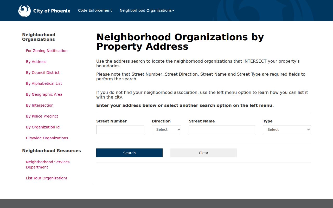
The address form is the precise route for one parcel and avoids assuming that a familiar neighborhood name matches the city's recorded boundary.
Search Phoenix organizations by geographic area.
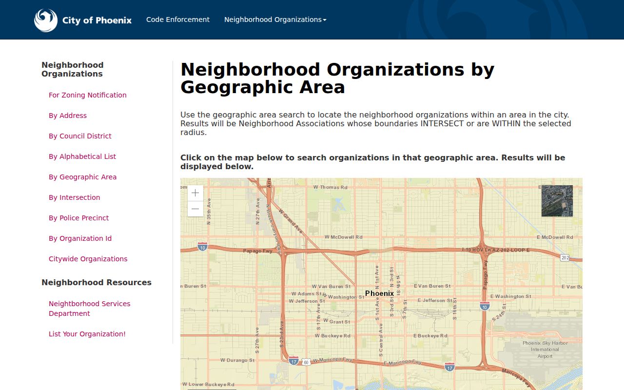
The area tool can surface nearby groups when a parcel falls near a boundary or when several small block watches overlap the search radius.
Review Phoenix neighborhood coordination resources.
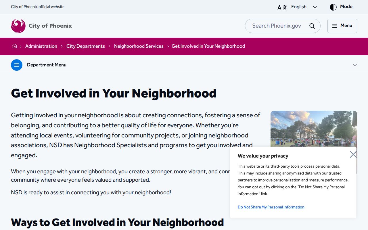
The city resource explains the civic layer behind Neighborhood Link. Private congregation, HOA, and block-watch member lists remain private unless their keeper chooses to share them.
Check Phoenix Nearby Address Files
Parcel ownership is only one view of the block. Phoenix certificate-of-occupancy search accepts a permit number, address fields, or APN. Results can show type and number, issue date, address, project, and contractor. The record documents an approved use or project event, not who slept at the address.
Open the Phoenix certificate-of-occupancy search.
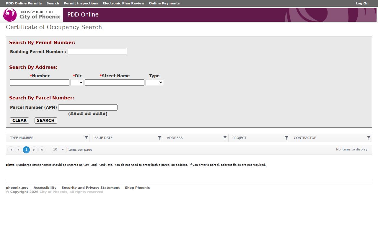
Search by APN when street wording is uncertain. The parcel key also helps distinguish nearby units or lots with similar addresses.
Neighborhood Services publishes code-enforcement status by case number or address, and partial street names are accepted. If the online status lacks needed detail, request the underlying file through the responsible city department. Redactions may protect sensitive facts. Planning and Development also maintains permit records, approved plans, site files, and archived material, with online permit research stated from 1995 forward.
Commercial addresses can have their own public safety trail. The county food-establishment inspection system is keyed to an establishment and inspection date. It does not identify every person connected to a nearby business.
Search Maricopa County food-establishment inspections.
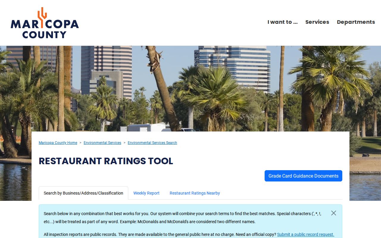
The inspection channel can document a regulated place on the block while keeping the claim tied to the business address and inspection record.
Note: A named applicant, contractor, owner, or business contact is evidence of a recorded role, not proof of current residence.
Phoenix Voter Data Is Not Directory
The Arizona Voter Information Portal authenticates a voter with private credentials and returns that person's status, districts, notices, ballot-by-mail status, and participation history. It cannot browse a Phoenix block. Participation history never reveals ballot choices.
Arizona law allows certain voter fields in authorized records, including name, party preference, registration date, residence and mailing address, ZIP, supplied phone, birth year, and recent participation history. Yet full lists are restricted to political or party activity, campaigns and elections, redistricting, or another expressly authorized purpose. Commercial use and unauthorized internet publication are prohibited. Protected voters can have identifying data sealed under state law.
Use the self-service portal only for your own status. A permitted request goes through the Maricopa County Recorder with the required purpose, certification, payment, and contact details. No result does not prove that a person left the block. It can reflect failed authentication, protection, suspension, or cancellation.
Compare Phoenix Neighbor Sources
Official records are narrower than a commercial compilation, but their custodian and event are clear. A parcel card reports an assessment fact. A permit reports city activity. A civic directory reports a group boundary. Commercial neighbor tools may merge purchased and public data, preserve old associations, or combine same-name people. A fee does not make a compiled listing current.
| Question | Official Phoenix or county source | Commercial compilation |
|---|---|---|
| Which parcels touch? | Parcel Viewer geometry and selected APNs | May simplify or omit parcel boundaries |
| Who owns each parcel? | Dated Assessor roll, checked against deeds | May lag a transfer or merge identities |
| Which civic group covers it? | Neighborhood Link boundary and listed contacts | May use an informal neighborhood label |
| Who occupies the home? | No complete open official roster | May infer or repeat stale associations |
Verify a claim at its original source and save the retrieval date. Correct parcel data with the Assessor, recorded filings with the Recorder, and city files with the department that keeps them. Removing a commercial listing does not erase the underlying public record.
Protect Phoenix Neighbor Privacy
A Phoenix neighbor lookup cannot reveal a complete renter list, utility subscriber, delivery account, child roster, or protected address. The public GIS layer itself omits owner mailing addresses, though the detailed parcel record may show one. Arizona's Address Confidentiality Program provides eligible survivors with a substitute mailing address and mail forwarding. It does not erase every older public record.
Use the least intrusive source that answers the civic question. Parcel shapes can identify affected lots without searching for personal contact data. Neighborhood Link can connect a resident with a registered group without exposing member names. If a source returns a protected or unexplained dead end, stop rather than trying to defeat it.
Lawful use. Use Phoenix block records for respectful civic awareness, reconnection, and safety. Public availability never permits stalking, threats, harassment, or intimidation.