
Mapping Phoenix ZIP Coverage
Phoenix postal coverage is best read in groups. Central codes follow the older core and long-settled corridors. Northern codes stretch through Deer Valley and the far-north fringe. Southern codes cover South Phoenix, southwest areas, and Ahwatukee. A second group carries Scottsdale, Paradise Valley, Glendale, Cave Creek, or Laveen postal labels even where the delivery geography intersects Phoenix. The source research did not identify official station names for each code, so the table sends that field back to USPS instead of guessing.
| ZIP | Areas Served | Post Office | Local Boundary Note |
|---|---|---|---|
| 85003, 85004 | Downtown and the Roosevelt or central core | Confirm with USPS | Core Phoenix |
| 85006, 85007 | Central historic districts and the capitol area | Confirm with USPS | Core Phoenix |
| 85008, 85009 | East and airport-north; west industrial areas | Confirm with USPS | City edges are irregular |
| 85012-85016 | Central and north-central corridors | Confirm with USPS | Crosses several villages and corridors |
| 85017-85021 | West-central, Alhambra, Maryvale, Sunnyslope and north-central | Confirm with USPS | Annexation history can affect the custodian |
| 85022-85029 | North Phoenix, Deer Valley, Paradise Valley Village and Moon Valley | Confirm with USPS | Paradise Valley Village is not the Town of Paradise Valley |
| 85031-85035, 85037 | Maryvale, west Phoenix and an east airport area | Confirm with USPS | 85037 overlaps the far west |
| 85040-85045, 85048 | South, southwest and Ahwatukee | Confirm with USPS | South Mountain shapes access and travel |
| 85050, 85051, 85053, 85054 | North, northwest and Desert Ridge | Confirm with USPS | A Scottsdale mailing label may appear |
| 85083, 85085-85087 | Far north and the Anthem or New River fringe | Confirm with USPS | Postal and city limits diverge |
| 85251, 85253, 85254 | Scottsdale and Paradise Valley postal fringe | Confirm with USPS | Verify each parcel's jurisdiction |
| 85310, 85331, 85339 | Glendale, Cave Creek and Laveen postal fringe | Confirm with USPS | Boundary maps show intersection or overlap |
This ZIP code directory is not a claim that every address in a listed code sits within the municipality. Official city arts and map material confirms the main intersecting codes, while boundary maps add the outer 853-series fringe. Use each grouping to narrow a search, then check the actual parcel before deciding whether Phoenix, Maricopa County, Pinal County, or another city holds the needed record.
Core Phoenix ZIP Code Patterns
The central 850-series reflects several eras rather than one neat ring. Downtown and Roosevelt sit near the territorial and early twentieth-century core. Garfield, Encanto-Palmcroft, Willo, and Coronado contain many homes from the 1910s through the 1950s. Maryvale points toward postwar growth, while Sunnyslope's earlier desert-community history predates later annexation. These eras guide which records may add useful context after a ZIP search.
A parcel in an older core may connect to a nineteenth-century deed, a historic map, a city directory, and later permit files. A Maryvale parcel is more likely to benefit from postwar directories, subdivision plats, and building records. ZIP data remains only the first filter. Legal descriptions and parcel jurisdiction can survive when street labels, neighborhood names, and city boundaries shift.
Note: Neighborhood names help select sources, but they do not replace an official parcel, postal, or municipal-boundary check.
Phoenix Fringe ZIP Geography
The outer codes show why postal names can mislead. Code 85254 may be called Scottsdale even where Phoenix geography is involved. The 85253 label points to Paradise Valley, while Paradise Valley Village is a Phoenix planning area and not the same jurisdiction. Far-north 85083 and 85085-85087 reach toward Anthem and New River. On the west and south edges, 85310 and 85339 bring Glendale and Laveen labels into the boundary discussion.
South Mountain divides Ahwatukee from the main central grid. Canals, reservation boundaries, freeways, and mountain preserves also interrupt streets and ZIP polygons. A postal address that says Phoenix can fall outside city limits, and a municipal Phoenix parcel can carry a nearby place name for mail. The Maricopa County Assessor's jurisdiction and legal description fields give a stronger government boundary clue than branding or a neighborhood label.
Boundary check. Treat a Phoenix mailing label as a delivery fact. Confirm city jurisdiction before sending a permit, code, or municipal-record request.
Search Phoenix ZIP Code Records
The Maricopa County Assessor and Parcel Viewer support a practical ZIP-based workflow. The Assessor's live page uses one optional box labeled “Search for Parcels, Addresses, and more.” It recognizes ZIP terms along with owner, address, parcel number, subdivision, and MCR queries. Parcel Viewer has a Zip Code item within its “By What I Know” mode and can also select parcels by shape. The authorized voter file includes a ZIP field, but the public self-service voter portal cannot browse residents by postal area.
- Verify the address or city-and-state result with the official USPS tool. Do not infer the code from a neighborhood name.
- Enter the ZIP in the Assessor search. Review the grouped parcel results and note the jurisdiction shown on a relevant record.
- Open Parcel Viewer and use its Zip Code search item or a spatial selection to compare the parcel area.
- If a lawful voter-record purpose applies, use the Recorder's request process. Do not try to turn the self-dashboard into a ZIP roster.
- Once the area is narrow, use the Phoenix street directory process for address-level work.
This route separates three facts that are often merged: the USPS delivery code, the county parcel's legal jurisdiction, and the record custodian. It also avoids treating an assessor owner as an occupant. A parcel result identifies ownership and property facts; renters and other household members generally do not appear.
Phoenix ZIP Search Fields
The ZIP-capable tools do not all ask the same question. USPS confirms postal addressing. The Assessor accepts a ZIP term in its broad search box and groups matching property data. Parcel Viewer works with a named layer or mapped selection. Arizona's voter dashboard authenticates one voter rather than returning everyone in a code. Choosing the wrong interface can make a valid search look empty.
| Official Tool | ZIP Input | Other Useful Input | What the Result Means |
|---|---|---|---|
| Assessor Search | ZIP in the unified optional text field | Owner, address, APN, subdivision or MCR | Property results grouped by record type |
| Parcel Viewer | Zip Code search item | Parcel, subdivision, MapID or section | Mapped parcel selection and attributes |
| USPS Lookup | City and state or a full address | Street details for one-address verification | Postal ZIP result, not city jurisdiction |
| Voter self-lookup | No public ZIP browse | Date of birth and state ID credentials | Authenticated registration information |
GIS search results can include owner name, APN, subdivision, lot, construction year, zoning, jurisdiction, and current or prior tax-year values. The parcel GIS layer does not publish the owner's mailing address. Open the detailed assessor card when a situs-to-mailing comparison is needed. “Situs” means the physical property location.
Verify Phoenix Postal Records
The USPS city and state lookup is the right starting point when only “Phoenix, Arizona” is known.
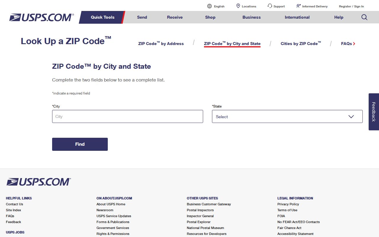
Its postal result narrows the possible codes, but the county parcel map still decides which local jurisdiction is tied to a specific property.
For one complete address, use the broader USPS ZIP Code Lookup and preserve the exact street direction and suffix.
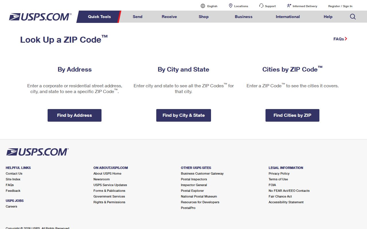
The verified postal code can then be carried into the Assessor search without assuming it proves Phoenix city limits. Street direction matters in the Phoenix grid. Central Avenue and Washington Street form the grid origin, and east, west, north, and south designations change there. Numbered routes west of the origin use Avenue, Drive, Lane, Glen, and Dale patterns, while the east uses Street, Place, Way, Terrace, and Run. A dropped direction or wrong suffix can point to the wrong parcel even when the ZIP looks plausible.
Phoenix ZIP Boundaries and Limits
ZIP areas serve mail delivery. They are not municipal wards, land plats, census tracts, or proof of where a city department has authority. Annexation adds a time layer: a parcel inside Phoenix today may appear in older records under unincorporated Maricopa County or a rural community. A current code cannot be projected backward over every deed, directory, or map.
- ZIP code
- A USPS delivery area used to route mail; it does not define Phoenix city limits.
- ZIP+4
- A more precise postal suffix attached to a ZIP for a smaller delivery segment.
- PO-box ZIP
- A code used for post-office-box delivery rather than a mapped group of homes.
- Unique ZIP
- A code assigned to one large recipient instead of a general neighborhood.
- Carrier route
- A postal delivery route within a broader ZIP area.
The research did not verify any Phoenix code as PO-box-only or unique, nor did it locate an official station list or a realignment year. Those labels should not be assigned from guesswork. Confirm the live USPS result and compare it with the city boundary map and Parcel Viewer.
Phoenix Situs and Mailing Clues
A parcel card can show a situs address and a different mailing address. The first marks the property location. The second tells the Assessor where owner mail goes. A mismatch may suggest that the owner receives tax mail elsewhere, but it does not prove why, and it does not identify every person at the property. That distinction is central when a ZIP code directory is used to narrow resident records.
Keep the parcel number and legal description beside the ZIP. They bridge across street changes and help distinguish two similar addresses. The Assessor's deed number can also connect the parcel to the name-keyed Recorder index. That next step is about title and named document parties, not about making a ZIP-wide household list.
Note: Use the property's situs ZIP for place-based research and treat an owner's mailing ZIP only as a separate contact clue.
Phoenix ZIP Geography Changes
Phoenix grew across land that once sat outside the city. Annexation means the custodian for an older record may not match the office that handles the parcel now. Far-north land can have a long county trail. South Phoenix records may call for community sources that preserve Mexican American and Black history. Arcadia creates a Phoenix and Scottsdale postal ambiguity. These are record-search facts, not just map trivia.
Older streets add another break. Phoenix replaced north-south names such as Montezuma and Apache with numbered names in 1893. A modern ZIP cannot repair that change. For historical work, match old maps, legal descriptions, deed parties, and directory entries before concluding that an address vanished. The ZIP code directory works best as a modern sorting layer placed above, not in place of, the older geography.
Use Phoenix ZIP Records Carefully
ZIP filtering can return many properties, but public access does not create a complete resident roll. The Assessor shows owners, not all occupants. The voter self-tool cannot browse a ZIP, and Arizona law limits full voter lists to stated purposes. Protected voters may have identifying facts sealed. Private community and association lists are not presumed public.
Use postal and parcel sources for lawful personal research, family history, civic study, or a careful check of record jurisdiction. Stop when a protected address or restricted record is involved. Never use a ZIP search to target, harass, or harm a person. When a result matters, verify it with the office that owns the original record.